300+ km Railway electrification

In the beginning of March 2020 we signed a contract to deliver topographical plans for the Vilnius bypass and Kaisiadorys-Radviliskis-Klaipeda railway electrification project. This project was the most expensive tender in the history of Lithuania. And we got a responsibility to make topographical plans with very precise accuracy in all parts between stations. And this project was not to investigate only the railway section, but all LTG Infra land plot, which in some parts exceeds 100 meter width. We are talking about thousands of hectares of railway infrastructure.

2 days after signing the contract, the Government of Lithuania has signed an entrance to a quarantine due to COVID-19 pandemic. It has had an impact on the process of all project due to the restrictions to movement, housing abilities in hotels etc. Biggest impact was done to our foreign partners due to very hard limitations in their country. Nevertheless we still manage to perform services during this more difficult time.
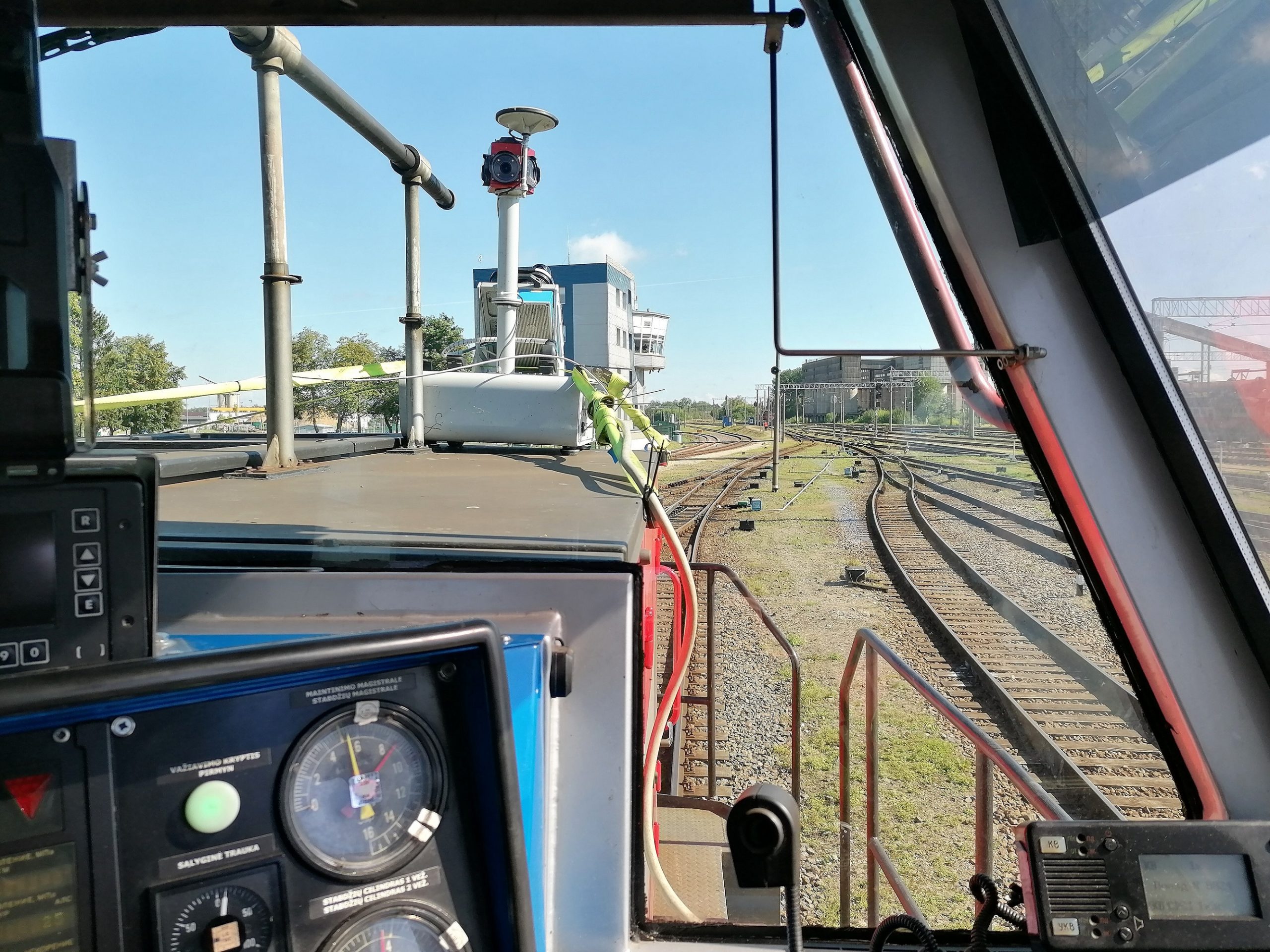
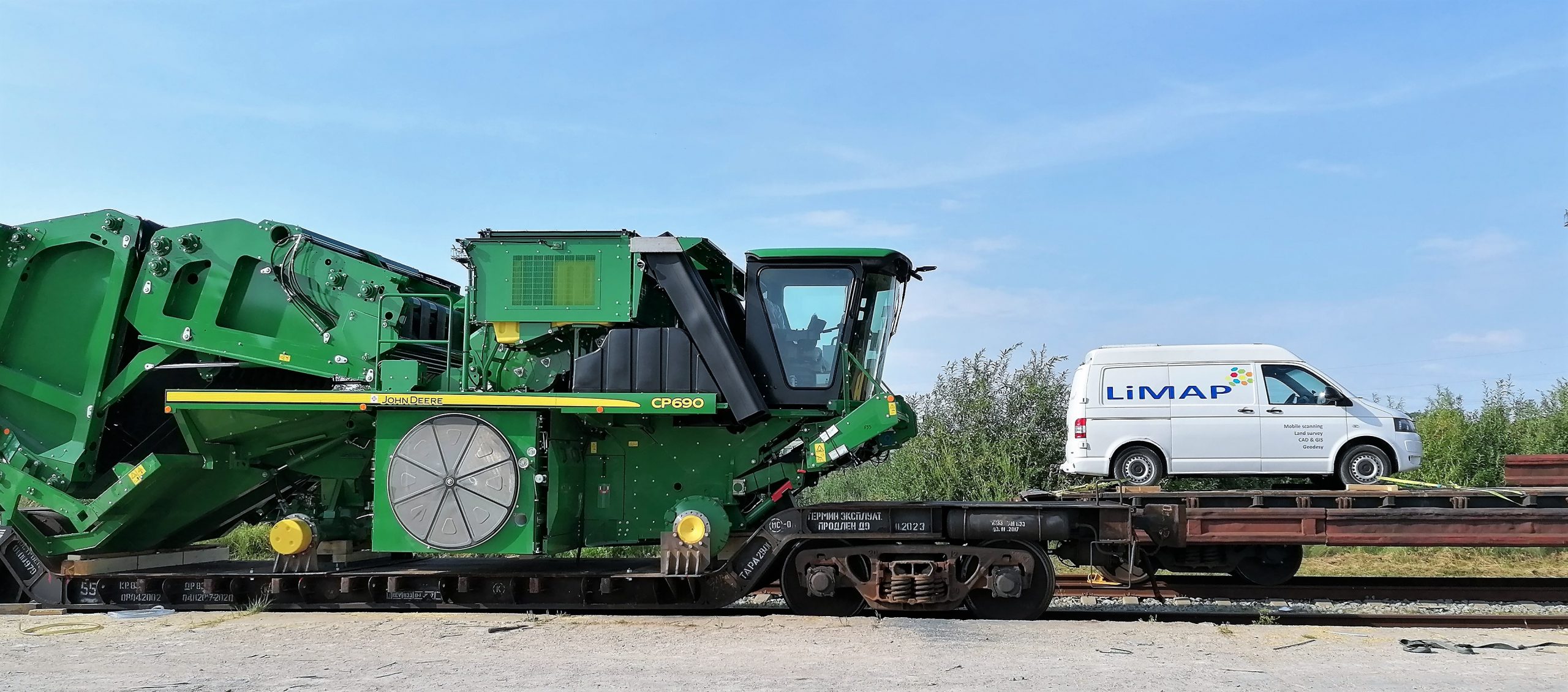
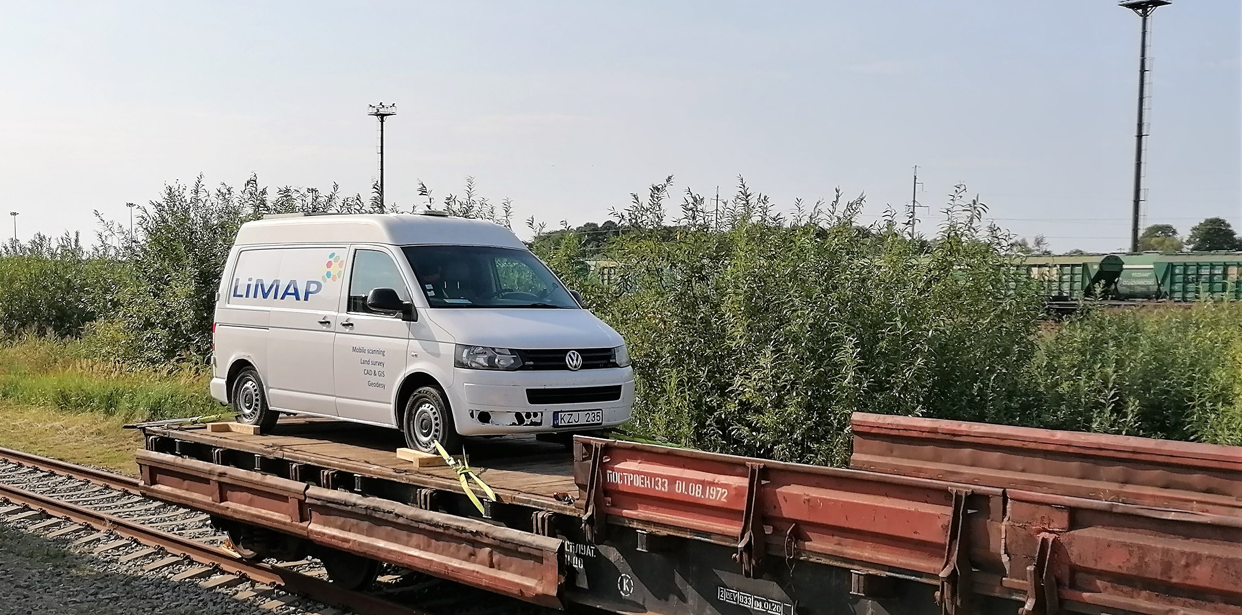
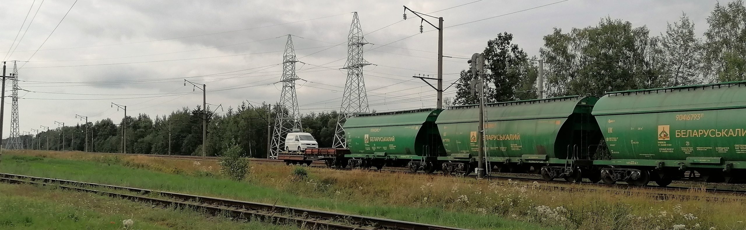
RAILWAY SCANNING
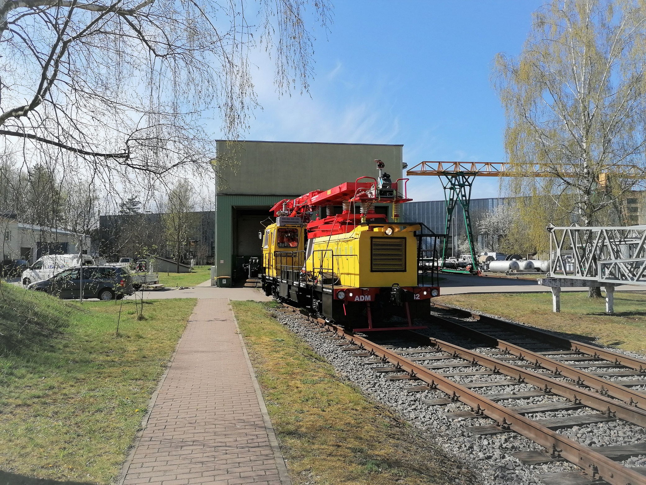
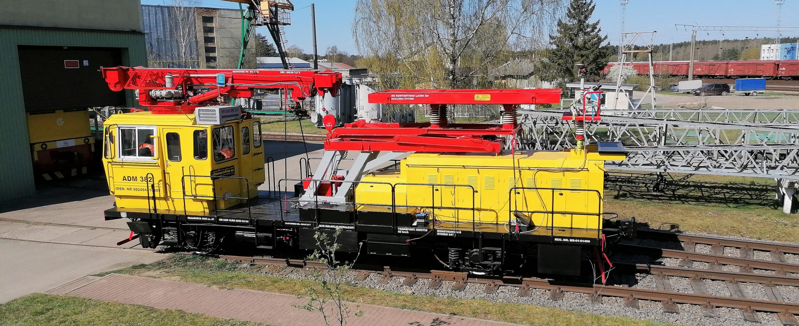
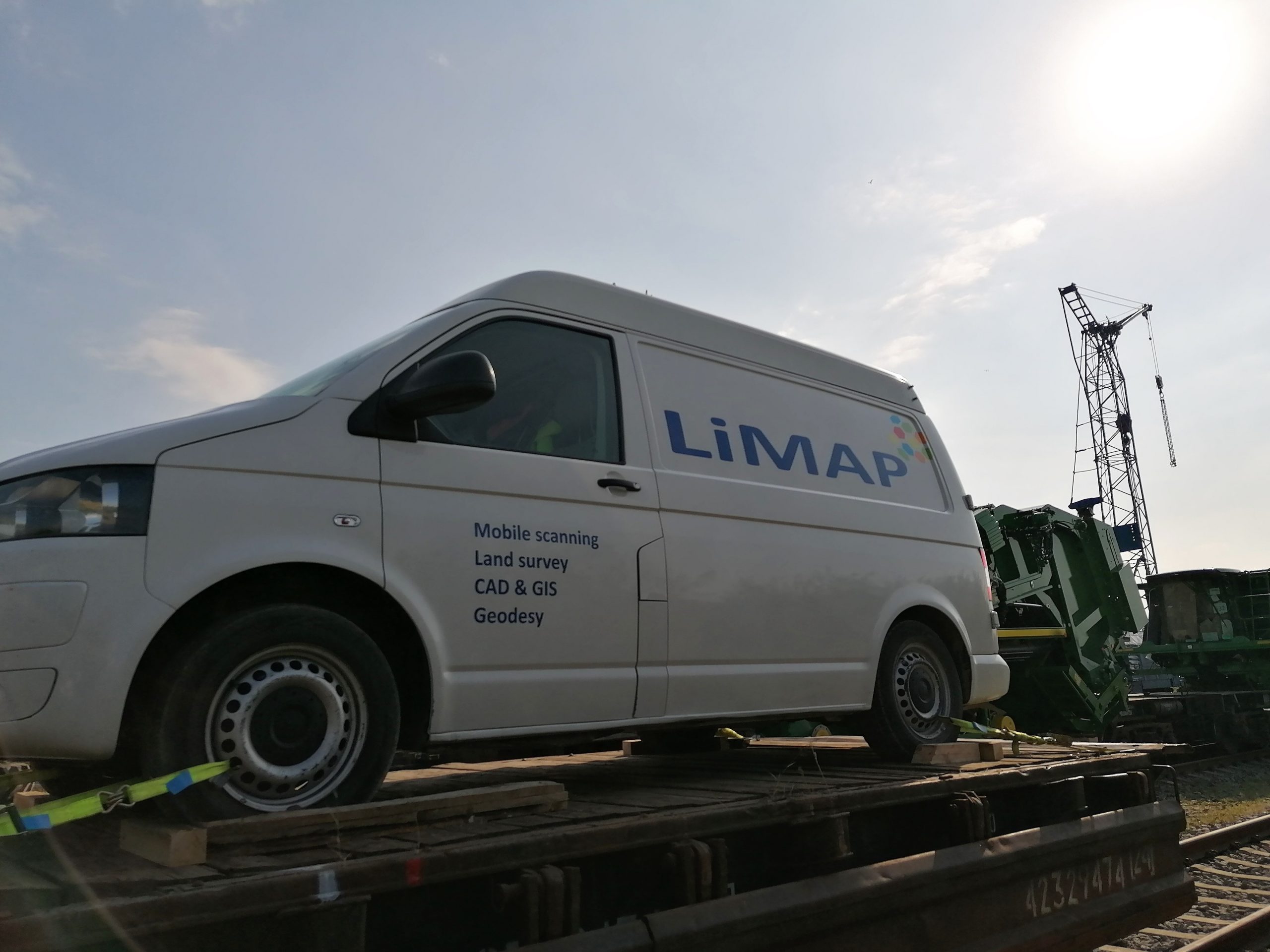
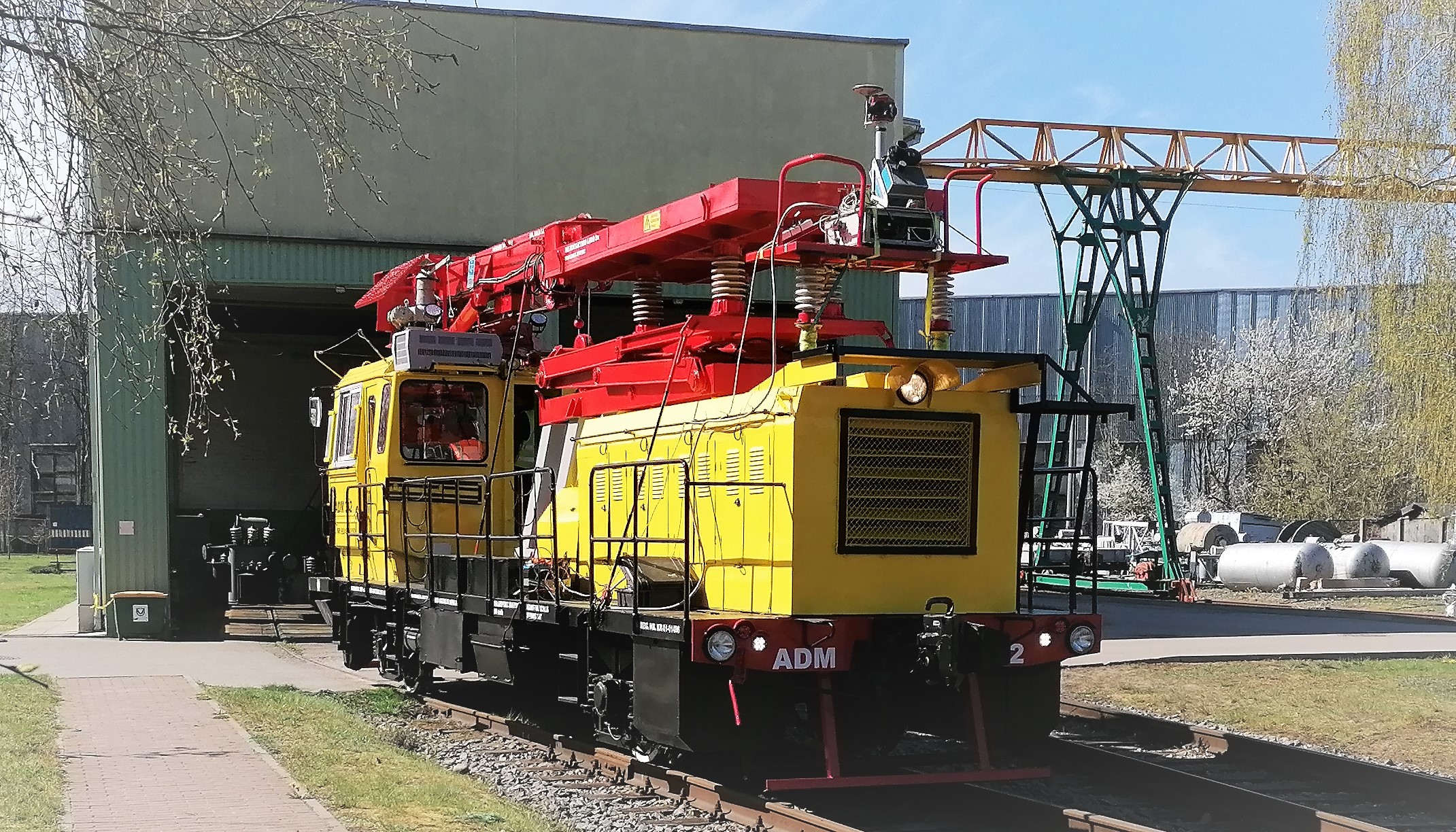
It is always fun to do scanning on the railway due to upcoming challenges in every drive. In this project we have tested Drezina ADM 382, TEM-TMH locomotive and a few platforms (individual drive with one locomotive + one platform and last platform of total 60 wagons train). And we can tell honestly that 12 car batteries is just enough to power our scanning system for a 24 hours scan with full power on!
For this project only railway scanning was not enough due to very wide limits and objects covering parts of territory. We also scanned each cross-section of railway and roads, all technical roads of railway infrastructure, each part where we could drive by.
And if that is not enough, we have done 2 flights forward and backward with airborne scanning, just to have detailed territory and save time for our Client. Pandemic has cut our ability to stay at hotels and to drive every day for 4-6 hours to the project and back would leave us ~ 2-4 hours for work per day… With such a process we would be doing this project until the Christmas of 2021 🙂 So we did what every good subcontractor should do – we took a little bit more expensive, but beneficier to Client, approach – we started the engine of a plane.
We have gathered so much data. It is about 3-4 TB of LiDAR scans and spherical images. We had to reserve 12 TB of storage for post-processing files, indexed files for different software and such.. Our two machines (server machine with 20 cores/40 threads (2 x E5-2630 v4) & 256GB RAM + workstation with 12 cores/24 threads (Ryzen 9 3900x) & 64GB RAM) named Liolix & Bolix respectively had some work to do 🙂
LAND SURVEY
Ofcourse, in this project we had to use more than scanning itself. First of all, for control and accuracy we have leveled control points all over this project. We checked our data to fulfill technical specifications. LTG Infra have geodetic marks each 1 km so this was quite a help to get precise measurements.
As mentioned, due to pandemic limitations, we could not do a lot of measurements of territory by GNSS or TS, but it does not mean that we haven’t done those at all. Most field measurements were done in Vilnius bypass due to it being closer to the Head office and it was Stage 1, part that we immediately started after the contract. Other stages got less field measurements and more distanced scanning.
DELIVERY
All in all, we have managed to finish this project. We delivered fully approved topographical plans for our Client with all railway infrastructure, objects in LTG Infra land plot and underground utilities. We know that our Client was satisfied with the result.