A5 Kaunas-Suwalki 56.83-85.00 km

State road A5 Kaunas – Marijampolė – Suwalki section from 56.83 to 85.00 km. This section is divided into 3 parts. The new Highway design in this section must transform the old road to the new and safer highway.
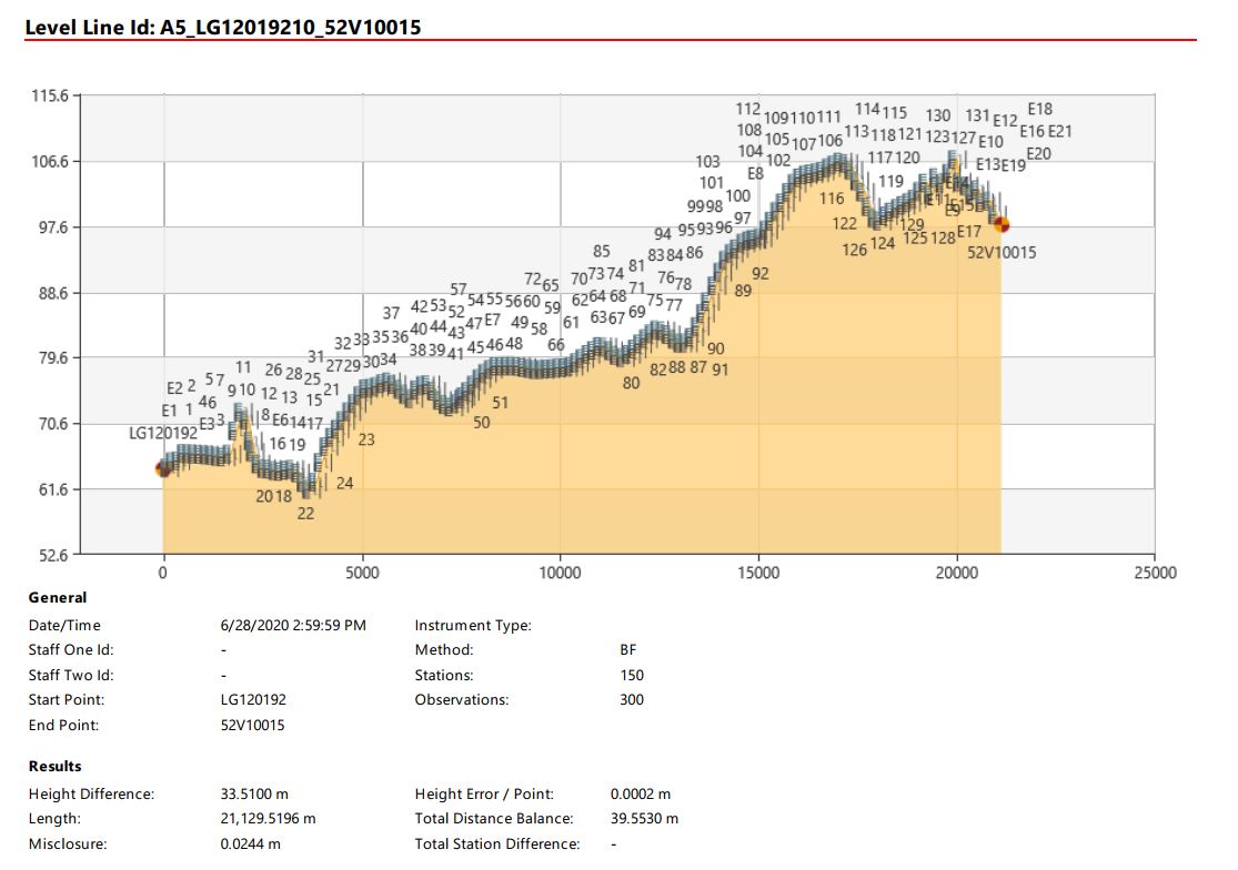
Our part was a full 2D & 3D topographical plan with leveling all over the road and modeling of total 765+ ha. 3D relief, road and bridges modeling, 3D underground utilities, wells investigation. It included a lot of details. Everything leveled to the high precision accuracy for further road building.
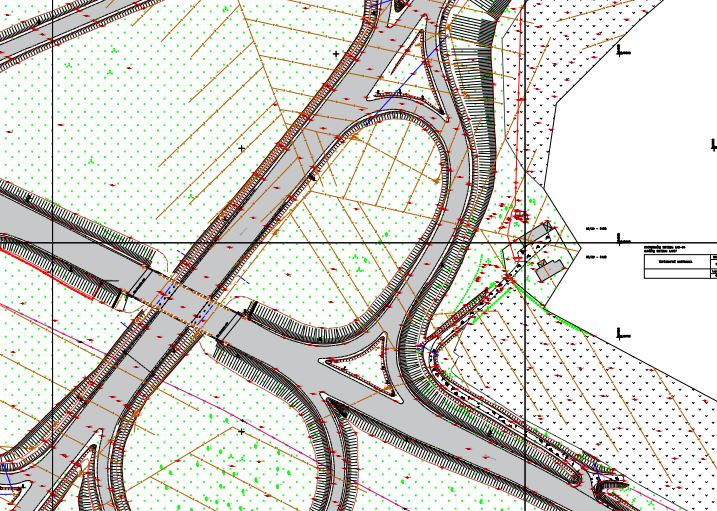
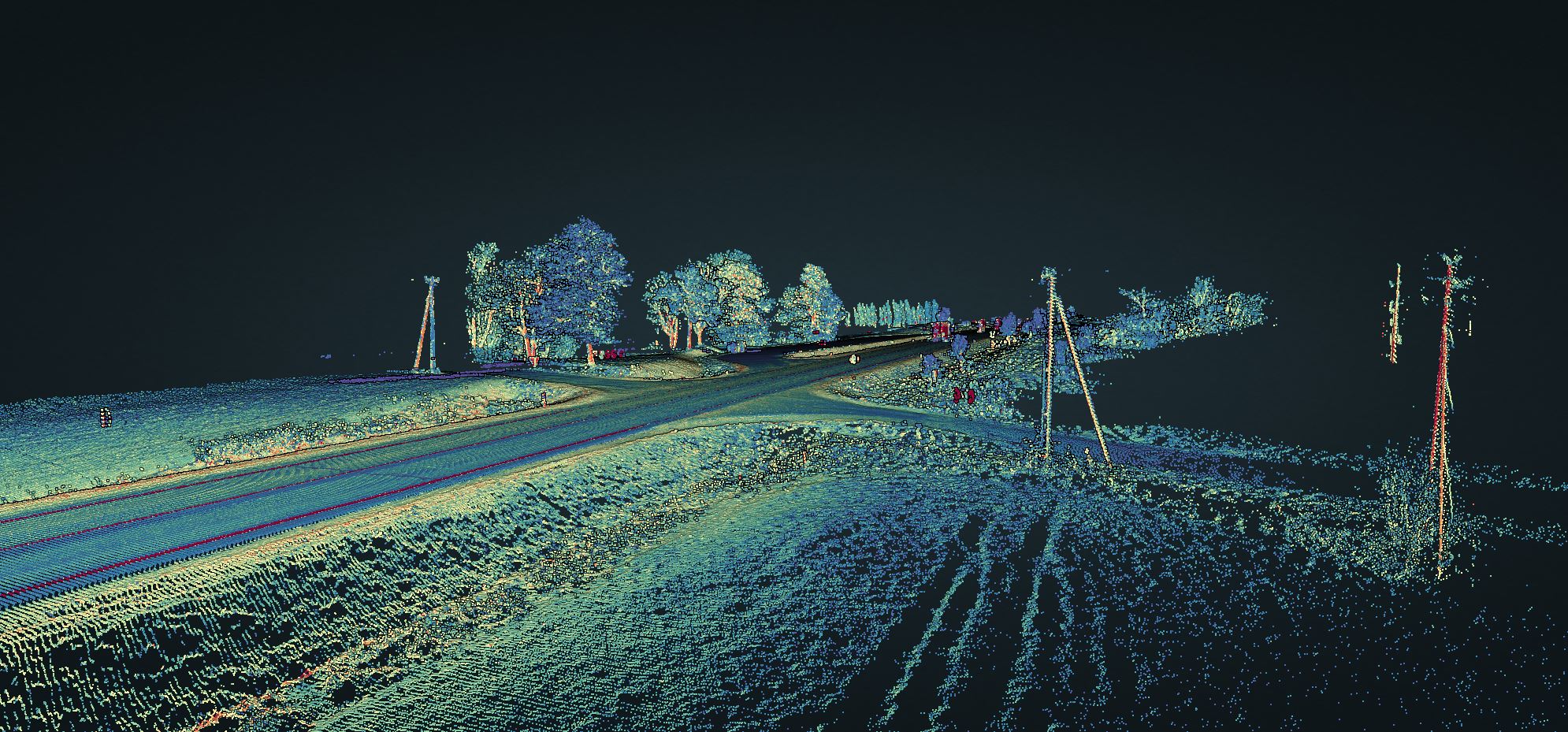
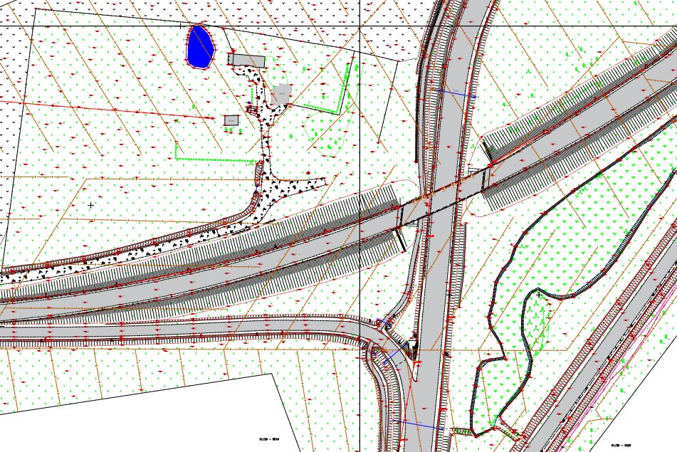
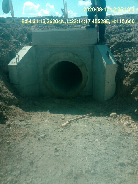
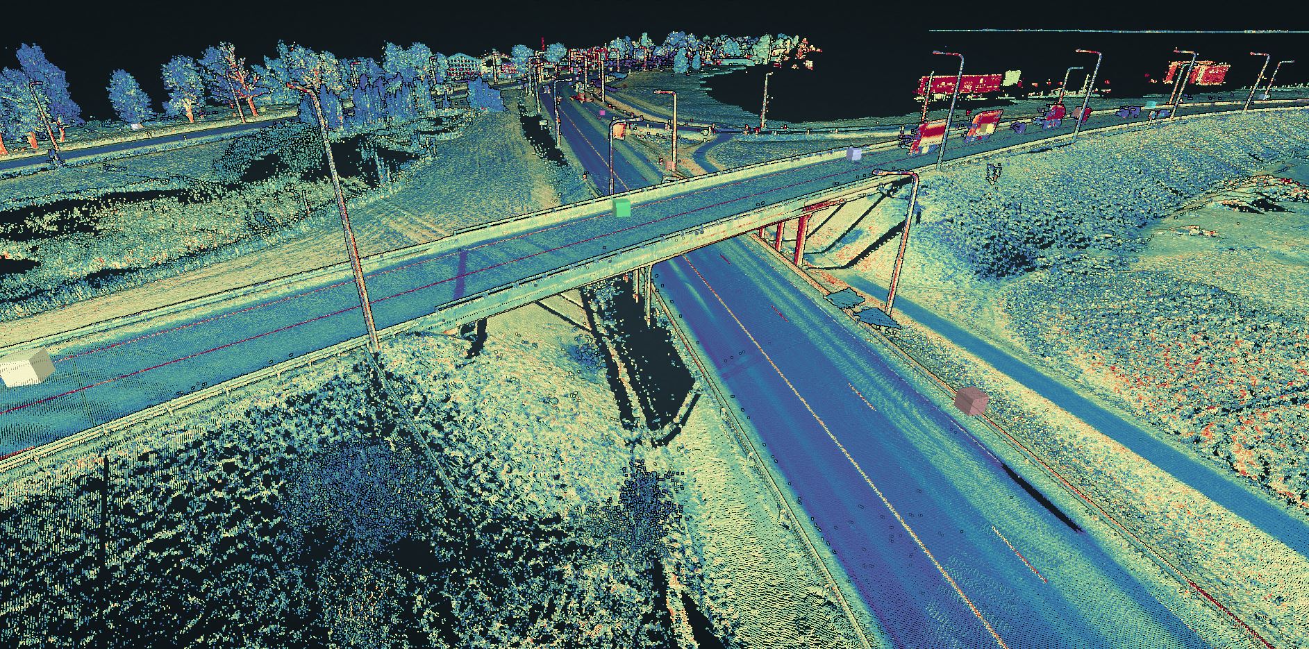
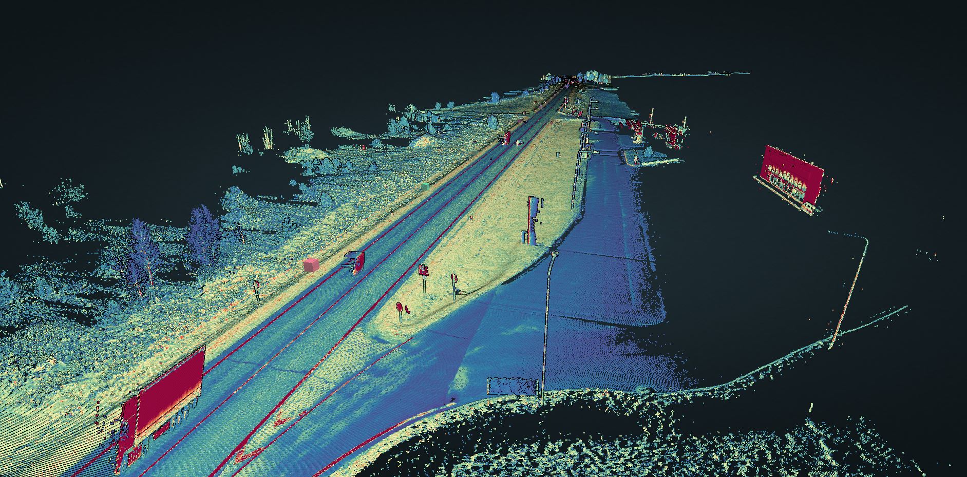
In this project we have scanned all territory with mobile and airborne LiDAR. Incorporating traditional surveying, wells investigation, making photos of all sluices, bridges. Our job is to deliver the existing road and it’s asset conditions for the designers so that they could make the best road build solution possible.
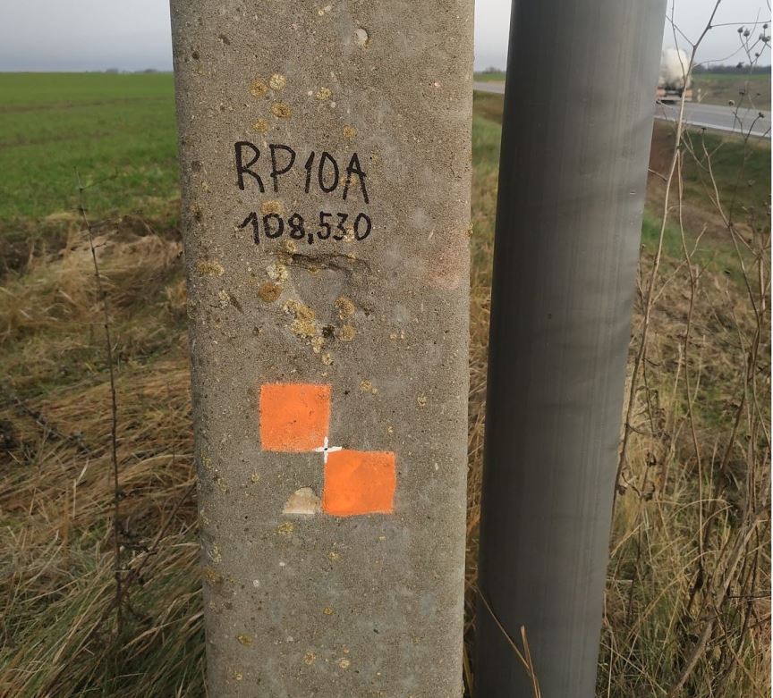
For leveling we marked permanent bases each 2 km. To make it more usable, we leveled temporary geodetic nail marks each 100 m all over the section. Geodetic network in this project is just great. No road constructor will be able to complain when they win a construction contract!
Detailed surface models will allow precise materials volume calculations, so that constructors would be able to evaluate real price. We put a lot of effort into ensuring the accurate representation of territory relief. And the territory was quite big, including very different types of areas. We also made different surfaces for relief with roads and bridges.
Topography was quite usual. 2D for the municipality and 3D for the client. Both are identical, so that our client could make designs under all regulations. It also included 3D information about the underground utilities. For that we had to communicate with all utility services providers and owners.
All in all, it was an interesting project due to its complexity and various services. Best of luck for the designers and constructors. Can’t wait to visit our Polish partners over this new and better highway in a few years.